Winter Weather &
High-Speed Rail
Both proposed corridors through Eastern Ontario experience serious winters. Understanding the different types of winter weather — and what they mean for an electrified railway — is essential context for the route discussion.
Winter weather is not a single problem. Heavy snowfall, freezing rain, ice storms, freeze-thaw ground cycling, and deep frost each create different engineering challenges for electrified rail — and the two proposed corridors face them in different proportions.
This page presents the available data from Environment Canada, peer-reviewed climate research, and published engineering studies so that community members can understand the winter weather differences between the two corridors and their implications for design, cost, and reliability.
This is not an argument for or against any particular route. Both corridors face real winter challenges. The point is that winter weather data should be evaluated critically prior to finalizing a route decision.
Alto says reliability is “designed into every kilometre.” We wanted to understand what that actually means.
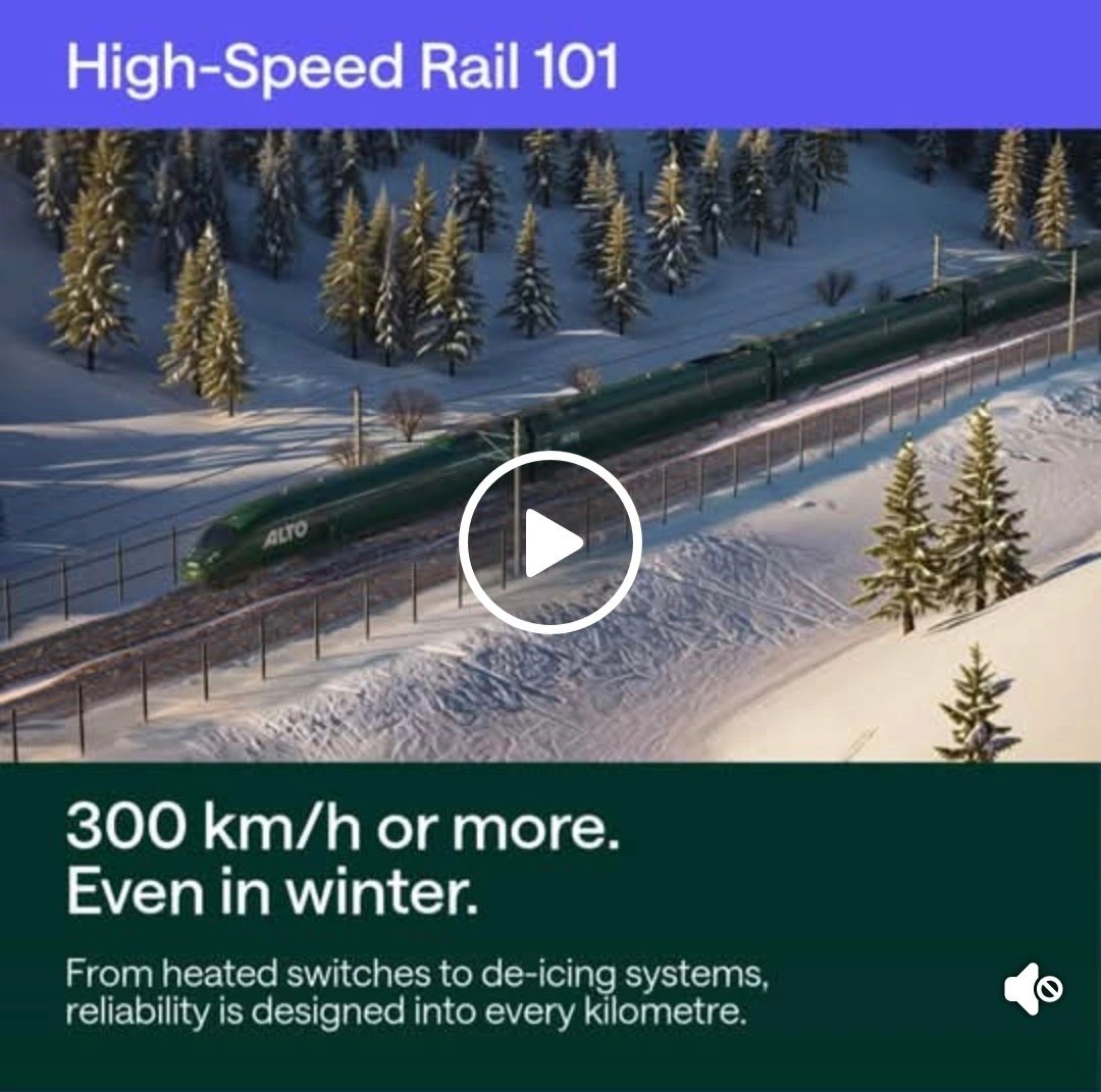
Alto HSR promotional ad, captured from Facebook, February 2026.
In February 2026, Alto ran a Facebook ad featuring a CGI rendering of a train cutting through a snowy mountain landscape. The tagline: “300 km/h or more. Even in winter.” The ad promised that “from heated switches to de-icing systems, reliability is designed into every kilometre.”
That’s a confident claim — and one that raised questions for those of us living in the Eastern Ontario corridors under study. Winter weather is not a single problem. Heavy snowfall, freezing rain, ice storms, freeze-thaw ground cycling, and deep frost each create different engineering challenges for electrified rail, and the two proposed corridors face them in different proportions.
We wanted to look at the publicly available data to understand what winter actually looks like along each route, and what that means for design, cost, and reliability.
Why winter weather matters for high-speed rail
High-speed trains run on electrified track and collect power from an overhead wire (called a catenary) through a pantograph — a spring-loaded arm on the roof of the train. This system is efficient and proven worldwide, but it is sensitive to winter weather in specific ways that conventional diesel rail is not.
Different types of winter precipitation create different engineering challenges. A railway designed around these conditions from the outset can manage them effectively. But the design, cost, and maintenance requirements vary depending on whether a corridor’s primary winter hazards involve heavy snowfall, freezing rain, ice accumulation, or ground freeze-thaw cycling.
The two corridors under study for Alto’s Peterborough-to-Ottawa segment pass through regions with different winter weather profiles. This page presents the available data so that community members can understand those differences and their implications.
Winter weather along each corridor
The figures below are drawn from Environment Canada climate monitoring stations located along or near each corridor. Freezing rain data comes from a study by the Institute for Catastrophic Loss Reduction using Environment Canada records from 1953 to 2001. Climate projections are from peer-reviewed simulations published in 2023.
Annual Snowfall
Peterborough 138 cm, Belleville 141 cm, Kingston 159 cm, Brockville 175 cm. Moderate snowfall, increasing eastward toward the St. Lawrence.
Bancroft 175 cm, Renfrew 195 cm, Sharbot Lake 197 cm, Lanark 211 cm. Heavier snowfall, reflecting the colder, higher-elevation Shield terrain.
Snow Days per Year
Measured at Peterborough to Kingston stations.
Measured at Lanark to Renfrew stations. More frequent snow events, consistent with heavier total snowfall.
Freezing Rain
Measured at the Kingston Environment Canada station. The southern corridor runs just north of the St. Lawrence Valley, where temperatures oscillate around 0°C during winter precipitation events — conditions that produce freezing rain rather than snow.
The Shield terrain has a colder baseline temperature. Winter precipitation is more consistently below freezing and falls as snow rather than supercooled rain. Freezing rain events still occur but are less frequent.
Ice Storm History
The southern corridor runs adjacent to the Kingston–Brockville–Cornwall segment of the St. Lawrence Valley — Ontario’s most active ice storm zone. Major events in 1998, 2013, April 2023, and December 2025 affected this area with significant intensity.
The same weather systems that produce freezing rain in the St. Lawrence Valley typically deliver snow at the higher, colder elevations of the Shield. Ice storms can still affect this area but with reduced frequency and intensity.
Projected Changes to 2050
Convection-permitting climate simulations project a 25–34% increase in freezing rain weather types across the St. Lawrence Valley and eastern Ontario by 2050.
The same research projects smaller increases in freezing rain frequency over the Shield. However, warming temperatures could shift some snowfall events toward mixed precipitation over the railway’s lifetime.
Freeze-Thaw Cycles & Track Stability
Milder, more variable winter temperatures cause the ground to freeze and thaw repeatedly. An NRC Canada study of 48 km of VIA Rail track between Kingston and Brockville measured 131 freeze-thaw cycles in a single mild winter — and found track roughness 46–86% worse the following spring than after a colder winter with fewer cycles.
The colder baseline means the ground freezes and stays frozen for longer periods — fewer transitions, but deeper frost penetration. This brings different engineering considerations: subgrade must be designed for greater frost depth, and drainage systems must account for a longer frozen period.
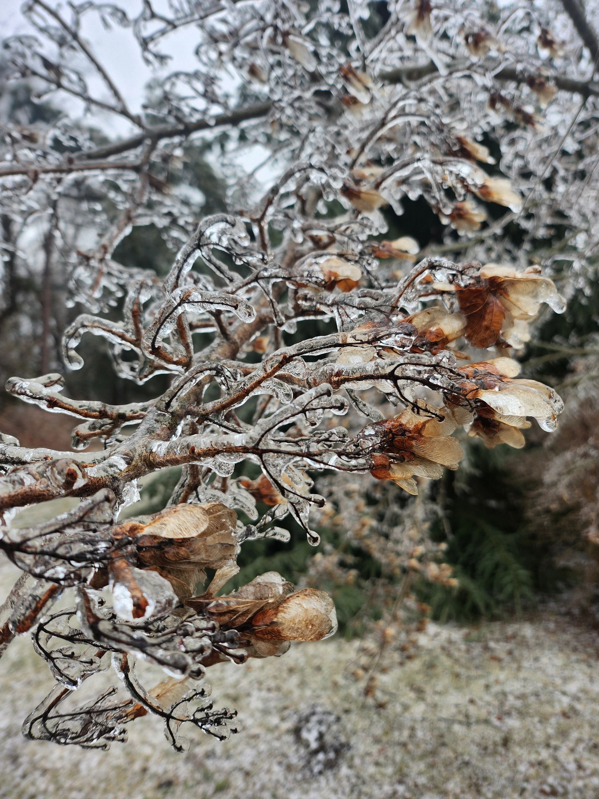
Ice accumulation on trees, Eastern Ontario. This is what freezing rain does — and what it would do to catenary wires, pantographs, and switch machines.
“Freezing rain and ice pellets are usually formed when there is a melting layer above a sub-freezing layer. The accumulation of ice on surfaces can cause major power outages, ground and air transport disruptions, and injury. These types of events are very common in Eastern Canada and in particular within the St. Lawrence River Valley.”
— Thériault et al. (2023), Changes in Freezing Rain Occurrence over Eastern Canada, PMC
How winter weather affects electrified railways
High-speed railways operate successfully in harsh winter climates around the world — in Japan, Scandinavia, northern China, and across Europe. The engineering to handle winter conditions exists and is well-proven. But the specific systems required, and their cost, depend on the type of winter weather a corridor faces.
Heavy snowfall
Snow on track and around switches is a well-understood railway hazard. Track heating, snowploughs, and blower systems manage it routinely. Japan’s Shinkansen network operates through regions receiving far more snow than either Eastern Ontario corridor. Heavy snowfall adds operational cost, but proven systems exist to handle it.
Freezing rain and ice accumulation
Freezing rain presents a different engineering challenge. When supercooled rain contacts the catenary wire, pantographs, signals, or switch machines, it coats them with ice. Ice on catenary causes arcing and power loss. Ice on pantographs causes contact failure and accelerated wear. Ice on switches can cause misalignment. Mitigation requires catenary de-icing systems, heated pantographs, and ice-protected switch machines — all of which add capital and maintenance cost.
Freeze-thaw ground cycling
Repeated freezing and thawing of the ground beneath the track causes differential heave — the track surface lifts unevenly as different soil types expand and contract at different rates. This is particularly acute at transition zones where the underlying geology changes. The engineering response includes frost protection layers, specialised subgrade design, and adjusted maintenance schedules.
Deep frost penetration
In colder corridors where the ground freezes to greater depth, the engineering challenge involves designing subgrade that accommodates deep frost while maintaining drainage. This is a different problem than frequent shallow cycling, but it still requires careful geotechnical assessment and tailored design.
Key Point
Every corridor will require winter-weather mitigation — the question is what kind, how much, and at what cost. Understanding each corridor’s specific winter profile is a necessary step in accurate route planning and cost estimation.
What’s under the ground matters too
The two corridors cross different geology. Each presents engineering considerations that interact with winter weather conditions.
The southern route crosses a ridge where the Canadian Shield surfaces through the St. Lawrence Lowlands. Exposed Precambrian granite alternates with deep deposits of frost-susceptible Champlain Sea clay. These abrupt geological transitions mean the ground can heave at very different rates over short distances, interacting with freeze-thaw cycling.
The northern route crosses Shield terrain with generally more uniform geology — but it includes areas of sedimentary rock, wetlands, and variable overburden depth. These present their own challenges for subgrade design, drainage, and construction access, particularly in areas with limited road infrastructure.
Geotechnical assessment of both corridors is a standard requirement in railway route selection. To date, Alto has not disclosed whether such assessments have been conducted for either corridor.
What the public consultation should address
Alto’s publicly available consultation materials do not include a comparative winter weather analysis for the two corridors. These are reasonable questions for the consultation process:
About This Page
This page is prepared by citizen researchers to help community members and future passengers understand how winter weather conditions differ across the proposed corridors, and why that matters for an electrified high-speed railway.
This is not an argument for or against any particular route. Both corridors face real winter challenges — heavy snowfall, freezing rain, ground conditions — and each requires different engineering responses. The point is that winter weather data should be evaluated critically prior to finalizing a route decision and this information should be available to the public.